How often does google earth update?
Google Earth is to act as a geographical browser that combines all the images received from satellites in composite form and binds them to form a 3D representation. Google earth was formerly known as the Keyhole EarthViewer.
According to the Google Earth blog, Google Earth updates about once a month. However, this doesn’t mean that every image is updated once a month – far from it. In fact, the average map data is between one and three years old.
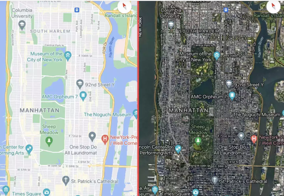
Google Earth is the three-dimensional planetary browser that shows our entire planet in satellite imagery and aerial photos. It should not be confused with Google Maps, as these are two separate software. Google Earth is another splendid product from Google that gives a 3D (three dimensional) image of Earth. The photographs come from satellites, obviously. It allows the users to see all around the world within their screen.
What does Google Earth update?
Google does not update the entire map every time. Instead, they update fragments of the map. When we say pieces, we mean small pieces. A single Google Earth update can cover a handful of cities or states. When Google releases an update, they also release a KLM file that outlines the updated fields in red, letting everyone know what’s changed and what’s still waiting on a refresher. doing.
Are images real-time in Google Earth?
Can you get real-time images of the places you visit? Well, the answer is no. If you thought you could zoom in on your current location and see yourself standing on the street, you might want to reconsider. All images were collected from different satellites. But satellites collect images as they orbit the Earth over time, and each satellite requires a specific cycle to manage and update the images.
How often does Google Earth update?
Google Earth updates every month, but a tiny fraction and it’s impossible for an average person to detect those updates. Every part of the world has some factor and priority. So the update of each part of Google Earth depends on these factors:
Location and Region:
Along with its own satellite, Google also takes pictures from various third parties to speed up its processes. Therefore, more updates accelerate faster on high-density areas.
Continuous updating of urban areas makes more sense than rural areas. Urban areas are more prone to change, and that requires Google to cope with the changes.
Time and Money:
You might have noticed that when you zoom in a lot, sometimes you can only see a blurry image, and sometimes you get a clear view of the car parking at your location. Google doesn’t have all the resources; He has to buy a certain part of his images from other parties. This is where the concept of time and money comes in. Third parties do not have time to send aerial photographs around the world; Nor do they have money to invest for it. Google can only purchase such images for essential high-density areas, so money and time factor into the update.
Street View:
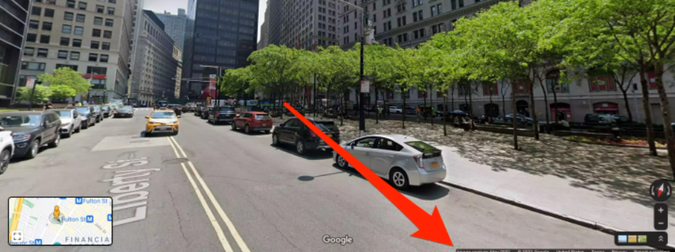
Street View the feature that lets you see real on-the-ground photos of almost any location in the US and beyond is probably Google Maps’ most famous feature. Keeping up-to-date is also one of the most difficult features, according to Google.
In general, Google tries to take new Street View photos in major cities once every year. Less populated areas can probably expect new photos every three years – but don’t be surprised if it takes even longer.
Security:
There are many secret locations, such as limited military bases, that are rarely updated for security reasons. Some of these areas have been blacked out forever. This is not only for government-led areas, but Google also stops updating areas where suspicions of using images for criminal activities arise.
How to get google map updates?
When Google Maps updates a specific location, you can set an alert on its Follow Your World tool. You receive an email every time Google updates a location you set as a Point. This is an excellent resource for anyone tracking updates and geographical changes to very specific locations.
If you want to get google map updates then you need a Google account to log in to the tool. Once you’re logged in then follow these steps:
- Go to the Home screen and enter a location in the Find a Location box.
- Select Search Location and drag the map until the + is on the spot you want to track.
- Click the Select Point button. The tool enters latitude and longitude for you.
- If you want to give the point a different name, change it in the Location Name box.
- Check that your email address is correct and select Submit.
- You receive an email notification confirming that you’ve set up the alert, with a warning that updates can take “weeks, months and even years.” Next time Google Maps updates this location, it will email you.
How do I know if my satellite image is updated?
Some other great sources of non-commercial, non-downloadable imagery are: Bing Maps Aerial. Mapbox Satellite Live. HERE WeGo Satellite.